A geospatial database powered by crowd-sensing for rural land analysis
The Universities involved in the Eye-Land project

Università degli Studi della Tuscia

Università degli studi di Udine

Università degli Studi Mediterranea

Università di Bologna

Università Politecnica delle Marche

Università degli studi di Messina
What is the Prin Eye-Land project:
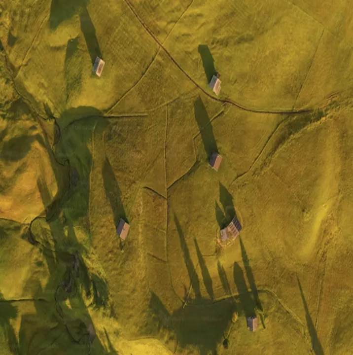
Eye-Land is an innovative project that uses crowd sensing to collectdetailed geospatial data on agro-forest and urban-rural areas in order to improve the classification of images obtained using remote sensing and to promote knowledge of the landscape and care for the environment.

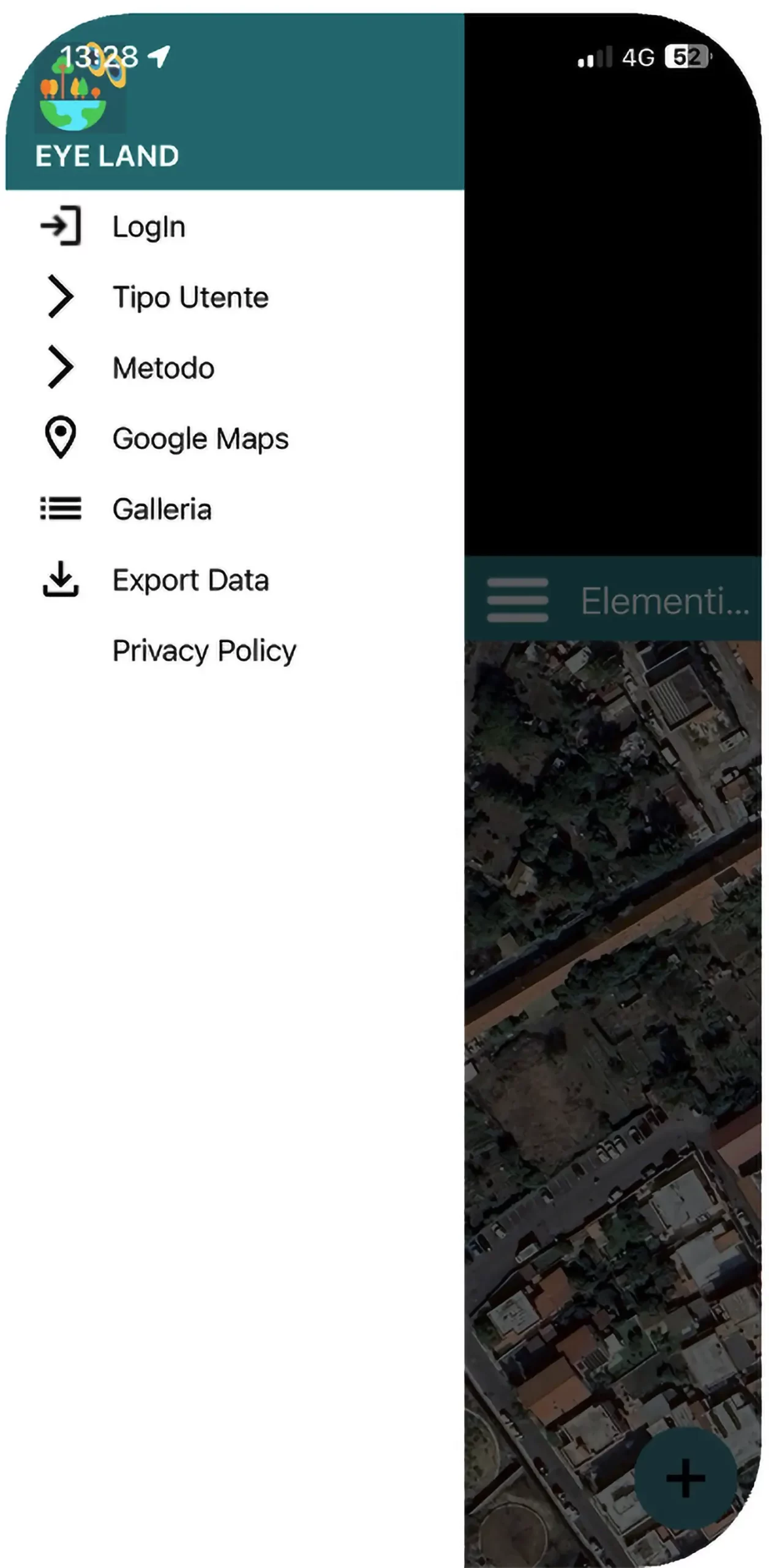
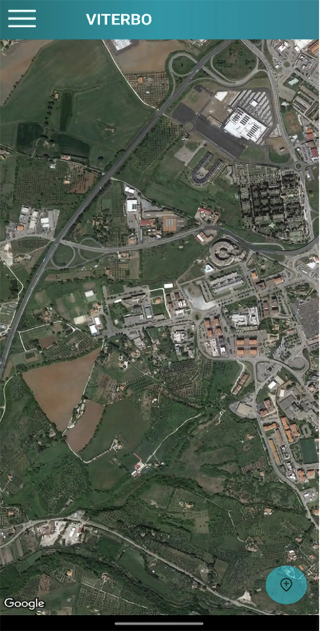
The Eye-Land Application
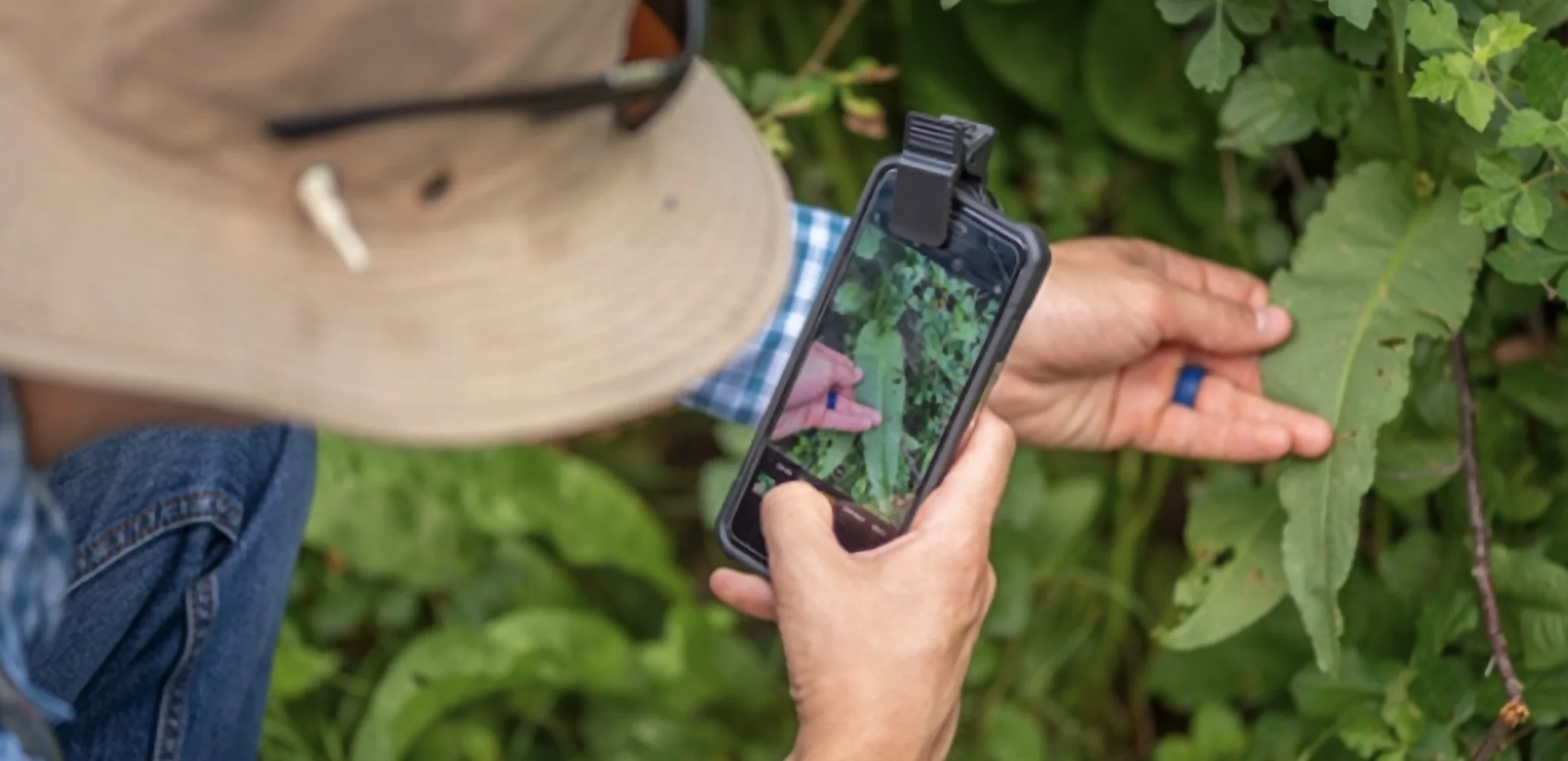
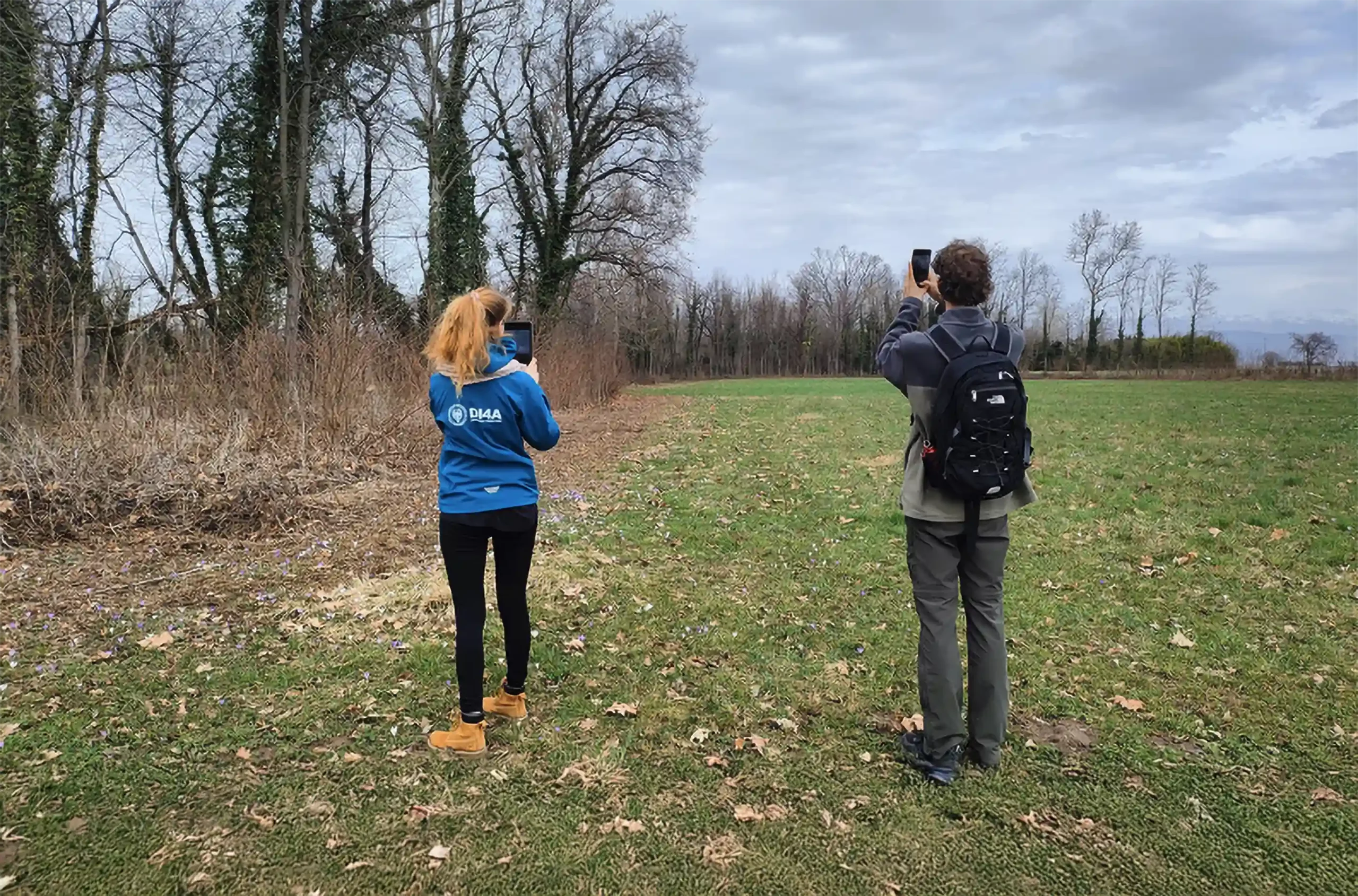
The Eye-Land app is a participatory monitoring tool that allows the collection of rural landscape data in an easy and immediate fashion.
By getting data directly from its users, it provides essential information for improving land management, supporting sustainable agriculture practices and optimizing the use of resources.
The app allows users to geolocate and share observations on land cover and crop status, creating a network of communal knowledge. With perpetually updated data that can be combined with information from other sources, EYE-LAND helps farmers, researchers and public institutions to make more informed decision for the stewardship and enhancement of the landscape
Different methods for data gathering
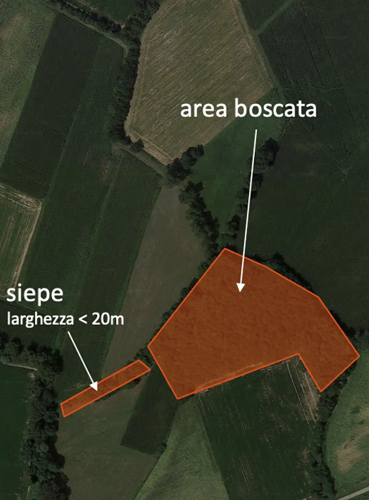
The Eye-Land app organizes the collected data into categories, allowing detailed and structured monitoring of the rural landscape.
Each category was designed to collect georeferenced data on specific elements, improving both analysis and management of environmental resources
Eye-Land App. Observe, share, protect.
The Eye-Land app can contribute significantly to different fields through the collection and integration of detailed geospatial data on rural and urban land use.
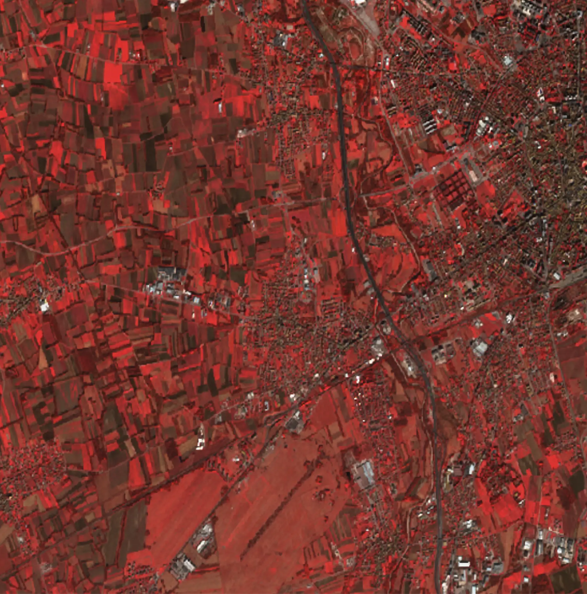
For scientific researchers, the collected data can be used by research institutes that study the change in land use using new technologies that use the classification of satellite images or images obtained by drones.
For land management, the data promotes the creation of detailed maps capable of improving and constantly updating our knowledge of the land, helping our pubblic representatives to formulate better strategies for sustainable development.

Data-collection Workshops
Thanks to the combination of scientific research, advanced technology and active participation from its users, the Eye-Land app allows access to a constant flow of reliable data for landscape monitoring.
The universities involved in the project have developped several demonstrative workshops that allowed users to demonstrate and share their findings.
